Log in
All resources
Create a design
947 Free Artworks of Maps Of The Netherlands
bibliothèque nationale de france
maps in the rijksmuseum amsterdam
1630s maps of the netherlands
maps by hendrik hondius the younger
prints of cartouches in the rijksmuseum amsterdam
national library of poland
dutch baroque architecture
old maps of haarlem
marble flooring in the netherlands
atlas ou representation du monde universel t. 1 (1633)
colombia
maps
colombia
maps
maps in the rijksmuseum amsterdam
old maps of franeker
old maps of breda, netherlands
adriaen jan bogaerts
claes jansz. visscher (ii)
maps of amsterdam
maps of amsterdam by braun & hogenberg
bibliothèque nationale de france
maps of rotterdam by berckenrode
baroque
17th-century maps of maastricht
baroque
maps of groningen by braun & hogenberg
bibliothèque nationale de france
maps of brielle by braun & hogenberg
brielle in the 16th century
old maps of utrecht (city)
baroque
maps from the earth and its inhabitants, vol. iii
rail transport in the netherlands
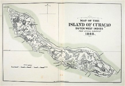
old maps of curaçao
johannes leupenius
atlas ou representation du monde universel t. 1 (1633)
1630s maps of the netherlands
atlas ou representation du monde universel t. 1 (1633)
1630s maps of the netherlands
atlas ou representation du monde universel t. 1 (1633)
1630s maps of the netherlands
atlas ou representation du monde universel t. 1 (1633)
1630s maps of the netherlands
maria johanna philipse
1933 in arnhem
atlas ou representation du monde universel t. 1 (1633)
1630s maps of the netherlands
koninklijk huisarchief collections
huis ter nieuwburg
theatre oft toonneel des aerdt-bodems (1571 kb)
typus orbis terrarum
cartography
maps
maps of gouda by braun & hogenberg
sint-joostkapel
lithographs in the rijksmuseum amsterdam
conrad leemans
old maps of katwijk, south holland
brittenburg
1890s maps of the netherlands
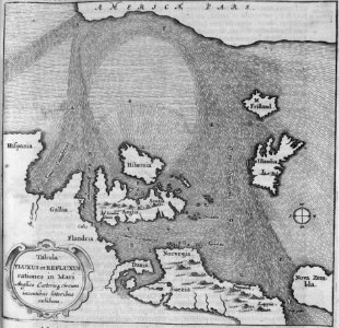
sea level maps of europe
cartography
maps
maps of haarlem by braun & hogenberg
bibliothèque nationale de france
400 years the netherlands – japan (memory of the netherlands)
portraits from koninklijke bibliotheek
dutch baroque architecture
nieuwe kerk, haarlem
17th-century maps of the spanish empire
maps of the spanish netherlands
old maps of the hague
carolus allard
pieter verbiest (ii)
maps from gallica
a system of modern geography (1810)
1810s maps of the netherlands
maps of meeresteijn
hendrik de leth
maps of the universiteit van franeker
maps in the rijksmuseum amsterdam
maps of dordrecht by braun & hogenberg
bibliothèque nationale de france
a flying trip to the tropics
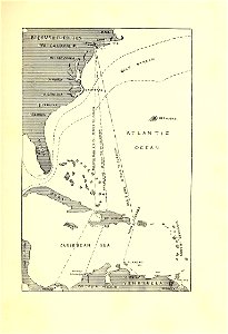
1895 maps of south america
maps in the rijksmuseum amsterdam
old maps of franeker
atlas ou representation du monde universel t. 2 (1633)
maps by hendrik hondius the younger
context files from gallica
pieter van der keere
atlas ou representation du monde universel t. 2 (1633)
maps by hendrik hondius the younger
prints of cartouches in the rijksmuseum amsterdam
maps in the rijksmuseum amsterdam
old maps of nova belgica et anglia nova
maps by willem and johannes blaeu
old maps of haarlem
mannerism
old maps of haarlem
haarlemmerhout
juliana of the netherlands in 1969
burgerzaal
juliana of the netherlands in 1969
dutch baroque architecture
juliana of the netherlands in 1969
dutch baroque architecture
map collection of leibniz-institut für länderkunde
1680s maps of the netherlands
veteris novae que urbis amstelodamensis ichnographia, continens publica aedificia ; veterem subnigrioribus... delineata auctore d. stalpaert - btv1b53212660h
bibliothèque nationale de france
veteris novae que urbis amstelodamensis ichnographia, continens publica aedificia ; veterem subnigrioribus... delineata auctore d. stalpaert - btv1b53212660h
bibliothèque nationale de france
maps in the rijksmuseum amsterdam
gerard valck
maps of amsterdam by braun & hogenberg
bibliothèque nationale de france
maps of the universiteit van franeker
maps in the rijksmuseum amsterdam
cartography
maps
maps in the rijksmuseum amsterdam
old maps of vlissingen
paris
maps
17th-century paintings in the amsterdam museum
paintings by pieter isaacsz
old maps of leiden
views of leiden
fortifications of charleroi
old maps of charleroi
juliana of the netherlands in 1969
dutch baroque architecture
maps from university of amsterdam special collections
atlas der neederlanden
high renaissance
pirro ligorio
leonard schenk jansz.
maps from gallica
beschrijvinghe vande zeeusche eijlanden, soe die op hare stromen geleghen zijn, met een deel vande zee custen van vlaenderen ennde hollant - btv1b532255648
bibliothèque nationale de france
beschrijvinghe vande zeeusche eijlanden, soe die op hare stromen geleghen zijn, met een deel vande zee custen van vlaenderen ennde hollant - btv1b532255648
bibliothèque nationale de france
beschrijvinghe vande zeeusche eijlanden, soe die op hare stromen geleghen zijn, met een deel vande zee custen van vlaenderen ennde hollant - btv1b532255648
bibliothèque nationale de france
map of amsterdam by gerrit de broen (ii)
bibliothèque nationale de france
map of amsterdam by gerrit de broen (ii)
bibliothèque nationale de france
map of amsterdam by gerrit de broen (ii)
bibliothèque nationale de france
map of amsterdam by gerrit de broen (ii)
bibliothèque nationale de france
maps of delft by braun & hogenberg
bibliothèque nationale de france
maps of amersfoort by braun & hogenberg
bibliothèque nationale de france
drawings by pieter jansz. saenredam in the beeldcollectie van de gemeente haarlem
siege of haarlem
schoten, netherlands
heerlijkheid zaanen
maps in the rijksmuseum amsterdam
old maps of the ottoman empire
heemstede, north holland
hendrik de leth
the sunbonnet babies in holland; a second reader (1915)
1910s maps of the netherlands
prints published by claes jansz. visscher (ii) in the rijksmuseum amsterdam
maps in the rijksmuseum amsterdam
princess margriet of the netherlands in 1979
dutch baroque architecture
pieter verbiest (ii)
maps from gallica
paintings by johannes vinckboons in the rijksmuseum amsterdam
old maps of ayutthaya
pieter jansz. saenredam
grote kerk, haarlem
maps by nicolas sanson
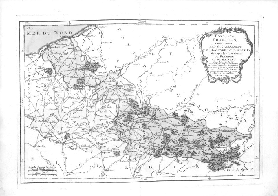
1720s maps of france
utrecht (city) in the 17th century
joost cornelisz. droochsloot
painters from the netherlands
history of suriname
prints of cartouches in the rijksmuseum amsterdam
maps in the rijksmuseum amsterdam
maps of bergen op zoom by braun & hogenberg
bibliothèque nationale de france
dutch baroque architecture
nieuwe kerksplein, haarlem
platte grond van amsterdam in 1878 - door a. braakensiek - btv1b53146318x
george lodewijk funke
platte grond van amsterdam in 1878 - door a. braakensiek - btv1b53146318x
george lodewijk funke
17th-century maps of venezuela
johannes leupenius
maps in the rijksmuseum amsterdam
1690s maps of the netherlands
marble flooring in the netherlands
burgerzaal
marble flooring in the netherlands
burgerzaal
maps of dordrecht by braun & hogenberg
bibliothèque nationale de france
collectie archief van architectenbureau baanders
photographs in the stadsarchief amsterdam
maps in the rijksmuseum amsterdam
old maps of south holland
18th-century paintings of battles
battle of khotyn (1673)
701 - 800 of 947
Next page
/ 10


![Rotterdam / [M. Merian], Matthäus Merian](https://cdn.creazilla.com/illustrations/10000529192/rotterdam-m-merian-matth-us-merian-md.jpg)


![Gerardi Mercatoris and I. Hondii Atlas or Representation of the Universal World, and of the Parts of It, Made in Tables and Descriptions Very Ample, and Exact: Divided into Two Volumes [...]. [t. 1].](https://cdn.creazilla.com/illustrations/10000447379/gerardi-mercatoris-and-i-hondii-atlas-or-representation-of-the-universal-world-and-of-the-parts-of-it-made-in-tables-and-descriptions-very-ample-and-exact-divided-into-two-volumes-t-1-sm.webp)
![Gerardi Mercatoris and I. Hondii Atlas or Representation of the Universal World, and of the Parts of It, Made in Tables and Descriptions Very Ample, and Exact: Divided into Two Volumes [...]. [t. 1].](https://cdn.creazilla.com/illustrations/10000414536/gerardi-mercatoris-and-i-hondii-atlas-or-representation-of-the-universal-world-and-of-the-parts-of-it-made-in-tables-and-descriptions-very-ample-and-exact-divided-into-two-volumes-t-1-sm.webp)
![Gerardi Mercatoris and I. Hondii Atlas or Representation of the Universal World, and of the Parts of It, Made in Tables and Descriptions Very Ample, and Exact: Divided into Two Volumes [...]. [t. 1].](https://cdn.creazilla.com/illustrations/10000896310/gerardi-mercatoris-and-i-hondii-atlas-or-representation-of-the-universal-world-and-of-the-parts-of-it-made-in-tables-and-descriptions-very-ample-and-exact-divided-into-two-volumes-t-1-md.jpg)
![Gerardi Mercatoris and I. Hondii Atlas or Representation of the Universal World, and of the Parts of It, Made in Tables and Descriptions Very Ample, and Exact: Divided into Two Volumes [...]. [t. 1].](https://cdn.creazilla.com/illustrations/10001439407/gerardi-mercatoris-and-i-hondii-atlas-or-representation-of-the-universal-world-and-of-the-parts-of-it-made-in-tables-and-descriptions-very-ample-and-exact-divided-into-two-volumes-t-1-sm.webp)

![Gerardi Mercatoris and I. Hondii Atlas or Representation of the Universal World, and of the Parts of It, Made in Tables and Descriptions Very Ample, and Exact: Divided into Two Volumes [...]. [t. 1].](https://cdn.creazilla.com/illustrations/10001109964/gerardi-mercatoris-and-i-hondii-atlas-or-representation-of-the-universal-world-and-of-the-parts-of-it-made-in-tables-and-descriptions-very-ample-and-exact-divided-into-two-volumes-t-1-md.jpg)


![Gerardi Mercatoris and I. Hondii Atlas or Representation of the Universal World, and of the Parts of It, Made in Tables and Very Ample Descriptions. [t. 2].](https://cdn.creazilla.com/illustrations/10000776653/gerardi-mercatoris-and-i-hondii-atlas-or-representation-of-the-universal-world-and-of-the-parts-of-it-made-in-tables-and-very-ample-descriptions-t-2-md.jpg)

![Gerardi Mercatoris and I. Hondii Atlas or Representation of the Universal World, and of the Parts of It, Made in Tables and Very Ample Descriptions. [t. 2].](https://cdn.creazilla.com/illustrations/10001371723/gerardi-mercatoris-and-i-hondii-atlas-or-representation-of-the-universal-world-and-of-the-parts-of-it-made-in-tables-and-very-ample-descriptions-t-2-sm.webp)


![Tables of the divisions of the seventeen provinces of the Netherlands / by Mr. Sanson, ordinary geographer to the King, [1692]](https://cdn.creazilla.com/illustrations/10000941957/tables-of-the-divisions-of-the-seventeen-provinces-of-the-netherlands-by-mr-sanson-ordinary-geographer-to-the-king-1692-md.jpg)


